New Mexico is brimming with world-class trails – these are the best Santa Fe hiking trails for all skill levels.
They are all top-rated and some of the most beloved by locals!
If youʻre booking your trip to Santa Fe last minute, we have you covered. Below are some of the top tours, hotels, and more!
Top Experiences and Tours in Santa Fe:
- E-Bike Adventure Tour (top rated!)
- New Mexican Flavors Food Tour (popular tour!)
- Santa Fe Architectural Walking Tour
- Santa Fe Haunted Spirits Tour (fun tour!)
- Taste of Santa Fe Wine and Dine Lunch
Top Hotels in Santa Fe:
- Rosewood Inn of the Anasazi (Lux)
- Las Palomas (Mid)
- Hampton Inn Santa Fe South (Budget)
We have included the best hikes near Santa Fe for the inexperienced hiker and for the well-seasoned one.
If you have any tips for the best places to go hiking in Santa Fe, please leave your trail recommendation in the comments! Thanks!
In this post...
Santa Fe Hiking Overview
Santa Fe, New Mexico might just be one of the most underrated cities for hiking in the United States.
There are over 100 Santa Fe hiking trails accessible and they traverse across various landscapes. Many of them are also fantastic for mountain biking and running.
You will find beautiful trails near Santa Fe in places like Hyde Memorial State Park or Cerrillos Hills State Park, but you’ll also find plenty in the parks in Santa Fe like Diablo Canyon and Arroyo Hono.
Best Time to Go Hiking in Santa Fe
One thing that people often forget when New Mexico comes to mind is that the north (and other parts of the state) has many high-altitude locations, meaning that the ‘desert’ image New Mexico has can often result in snow and cold weather.
However, you will find that Santa Fe and other places in New Mexico still offer fantastic hiking opportunities whereas many other cities will shut down in unfavorable conditions.
Santa Fe locals know how to make the most of their surroundings regardless of the weather and it shows!
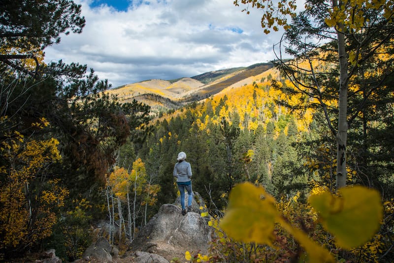
The best time for a bit of Santa Fe hiking is during the shoulder seasons in spring and fall. Temperatures are comfortable and you may witness foliage if near the forest or wildflowers during the spring months.
However, summer is also a great time for hiking if you go to a higher altitude. And winter offers a plethora of Santa Fe hikes for those that are keen to trek through the snow or colder temperatures.
This is why New Mexico is great – it really has something to do all year round!
Map of the Best Trails near Santa Fe
To add this map to your Google Maps account, click the ‘Star’ icon next to the map name. You can then view it on your cell phone or computer by heading to your Google Maps account, click the menu and add it to ‘Your Places’.
Best Santa Fe Hiking Trails – The List
There are several wonderful hikes near Santa Fe – here is a list of the ones we have specifically chosen for this guide. All are top-rated and loved by locals.
Let us know your favorites in the comments (we only cover 9 here so we hope to hear about other hikes from you)!
- Easy: Tsankawi Ruins Trail, Dale Ball Trails North, Grasshopper Canyon Trail
- Moderate: Nambe Lake Trail, Atalaya Mountain Trail, Picacho Peak Trail
- Difficult: Deception Peak and Lake Peak, Santa Fe Baldy via Windsor Trail, Raven’s Ridge
Best Easy Day Hikes
Tsankawi Ruins Trail
Distance: 1.6 miles
Type of Trail: Loop
Elevation Gain: 236 feet
Location: Bandelier National Monument
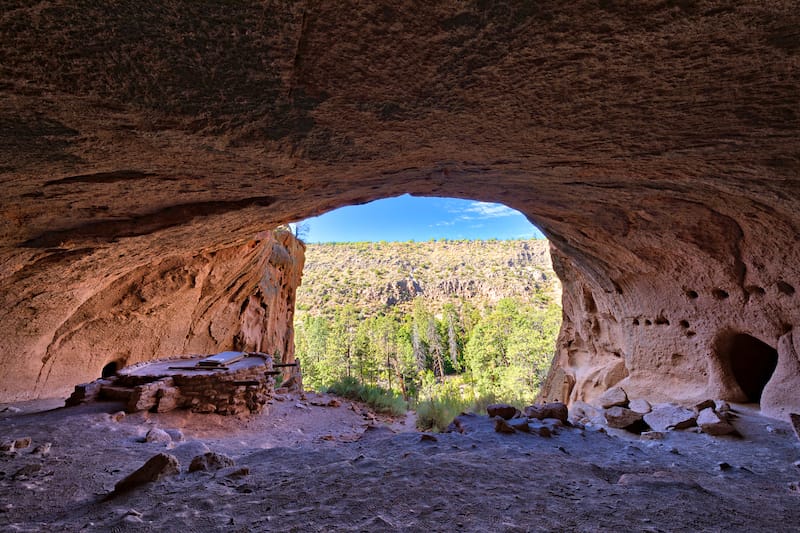
There are many easy day hikes near Santa Fe and one of the most renowned is the Tsankawi Ruins Trail located in Bandelier National Monument, one of our favorite places in New Mexico!
This trail is short at only 1.6 miles and is a loop that is heavily trafficked. It is an easy hike for all skill levels and is perfect for hiking, birdwatching, and checking out the stunning wildflowers when they are in bloom.
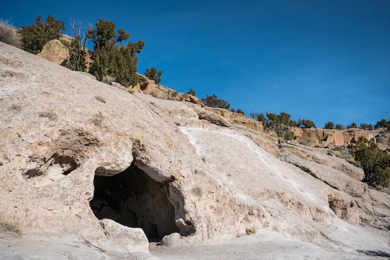
Tsankawi Ruins Trail is rocky and appropriate shoes must be worn! A lot of the hike goes atop volcanic ash (tuff). This is a very sensitive material and should be hiked on with caution.
Some of the lower loop is rocky and other parts are sandstone, so it offers a bit of variation.
Throughout the trail, you will find two kiwa ladders – one is around 10 feet and the other is around 20 feet.
One thing to note about this hike is that since it is inside of Bandelier National Monument, there is a fee to enter. The fee is $25 per vehicle or $20 per motorcycle. If you show up on foot, it is $12.
The park-specific passes are $45, or you can alternatively purchase a National Parks and Sites pass for $79.99… and that will get you into over 2,000 other designated sites around the United States!
Dale Balls Trail North
Distance: 4.4 miles
Type of Trail: Loop
Elevation Gain: 567 feet
Location: Santa Fe, NM
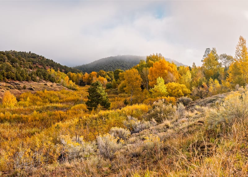
The Dale Balls Trail North is one that is easily accessible from the city limits and is a heavily trafficked loop trail in Santa Fe.
It is accessible year-round and dogs are permitted if on leash.
One of the great things about this trail is that it is easy when it comes to the hike itself, but it has a longer duration, which is perfect for those looking to spend a decent portion of their day in the wilderness.
Some of the activities you will find on the Dale Balls Trail are birdwatching, hiking, running, mountain biking, and more!
This trail is more forested in places and more deserty in others, making the terrain interesting along the route. It is a well-marked trail but please note that some parts of it are louder with noise from the local traffic. Opt to head there mid-week to avoid crowds.
This trail makes for one of the best day trips from Santa Fe!
Grasshopper Canyon Trail
Distance: 3.1 miles
Type of Trail: Out & back
Elevation Gain: 278 feet
Location: Santa Fe National Forest
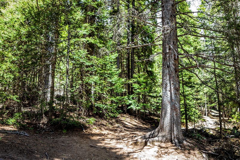
A top-rated Santa Fe hiking trail is the Grasshopper Canyon Trail in Santa Fe National Forest. This trail is moderately trafficked and spans over the course of 3.1 miles.
The out and back trail is used mostly for running and hiking and dogs are permitted if they are on a leash.
It is the perfect Santa Fe day hike for those of any skill level that are just looking to escape the city for fresh pine air and beautiful scenery.
It is recommended to download an offline map before taking to the trail! The trail is not well-marked and can be a challenge without proper navigation despite being fairly easy.
If you opt to do this hike in winter, beware that you may have some areas of the hike where you need to pass over iced water. It can be slippery so wear proper footwear (you can see our recommendation at the end of the post).
Please also note that while dogs are permitted, there are some questionable areas where there is loose driftwood wedged between the canyons that can be a bit of a challenge or impose danger to the pup.
It is also possible to make this a loop by jeering off to the East Grasshopper Trail (but the path to do this is usually very overgrown)!
Best Moderate Hikes
Nambe Lake Trail
Distance: 6.5 miles
Type of Trail: Out & back
Elevation Gain: 2,089 feet
Location: Santa Fe National Forest
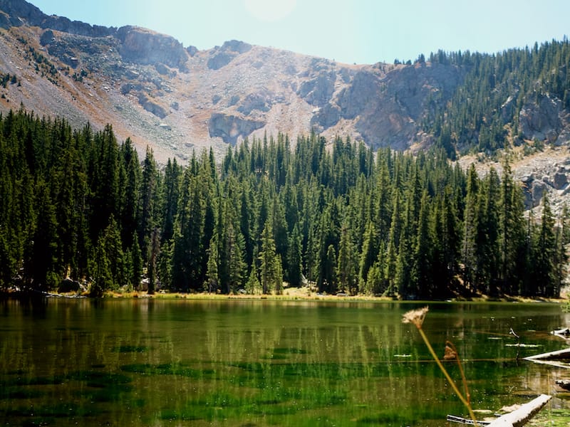
Nambe Lake Trail is the top-rated trail in Santa Fe and it is of moderate difficulty and a fan favorite amongst locals! Dogs are permitted on the trail and, of course, the highlight of this Santa Fe hike is the gorgeous lake you will hike to!
Nambe Lake is a heavily trafficked hike and is best used from May until October.
Some of the activities that are popular there are snowshoeing in winter, hiking, birdwatching, running, and checking out the beautiful wildflowers in spring and summer.
This hike starts at the parking lot area of the Santa Fe Ski Area. Be sure to keep an eye out for ‘Windsor Trail‘ sign and not Nambe! When this trail starts out, you will have an immediate incline (moderate difficulty) before trekking along the well-kempt trail.
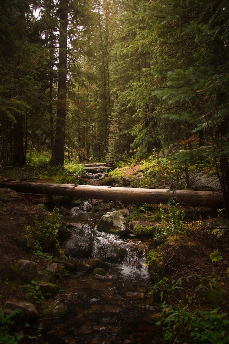
There are plenty of Aspen and pine trees along the route and most of it is shaded with views of the valley and Mt. Baldy.
Once you get to the bottom (you will know because there is a creek there), be sure to look out for the sign that says ‘Nambe Lake’. Follow this and you’ll be on your way.
Nambe Lake is small, but stunning, nevertheless! Be sure to take an offline map with you just in case!
Atalaya Mountain Trail
Distance: 6.4 miles
Type of Trail: Out & back
Elevation Gain: 1,794 feet
Location: Santa Fe National Forest
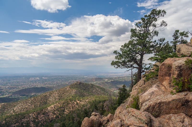
Another beloved Santa Fe hiking spot is the Atalaya Mountain Trail in the Santa Fe National Forest. This 6.4-mile, the heavily-trafficked trail is located in the forest and offers a welcome respite on a hot summer’s day!
The trail activities that are popular are hiking, running, mountain biking, and more. It is a year-round trail and dogs are permitted if they are on a leash.
This is a lovely day hike from the St. John’s College Trail and is situated on the east side of Santa Fe. It gets quite busy on weekends, even in winter, so opt for a weekday if you have the opportunity.
Picacho Peak Trail
Distance: 3.3 miles
Type of Trail: Out & back
Elevation Gain: 1,227 feet
Location: Santa Fe National Forest
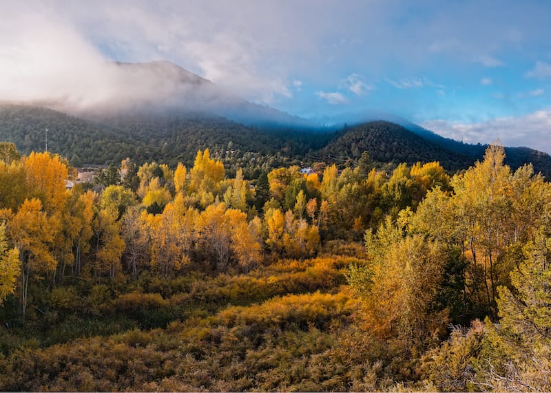
The Picacho Peak Trail is one of the most talked-about trails in Santa Fe and the heavily trafficked trail is located in Santa Fe National Forest. It is of moderate level and is best used from June until October, but is technically accessible year-round.
Dogs are permitted on the trail but they must be on a leash.
If you’re hiking this trail during the winter or colder months, beware that it can become snowy and even icy at times, so crampons are recommended if you struggle with gait or grip on your shoes. It is the shaded area that gets icy, so be cautious.
One of the top reasons to head to this trail is that the views over Santa Fe are epic. Some previous hikers state that the Picacho Peak Trail is closer to 4 miles, not 3.3.
Best Difficult Hikes
Deception Peak and Lake Peak Trail
Distance: 6.6 miles
Type of Trail: Out & back
Elevation Gain: 2,601 feet
Location: Santa Fe National Forest
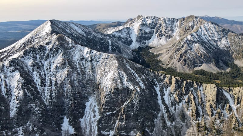
This fantastic Santa Fe hiking trail is heavily trafficked and features a lake. However, this is really only recommended for super skilled hikers who are well-seasoned on rough terrain.
Deception Peak and Lake Peak Trail is best used from June until October and dogs and horses both are permitted along the trail.
You will face a bit of scrambling and should really take an offline map with you. There are several other tangents and trails that lead off of the hike. It is a lightly-trafficked Santa Fe trail.
This hike is known to be difficult due to its steepness. Lake Peak is a bit of a scramble but worth it in the end!
If you happen to hike this during winter, please dress accordingly. There are reports of hikers having to go through thigh-deep snow in some areas.
Santa Fe Baldy via Windsor Trail
Distance: 13.5 miles
Type of Trail: Out & back
Elevation Gain: 3,517 feet
Location: Santa Fe National Forest
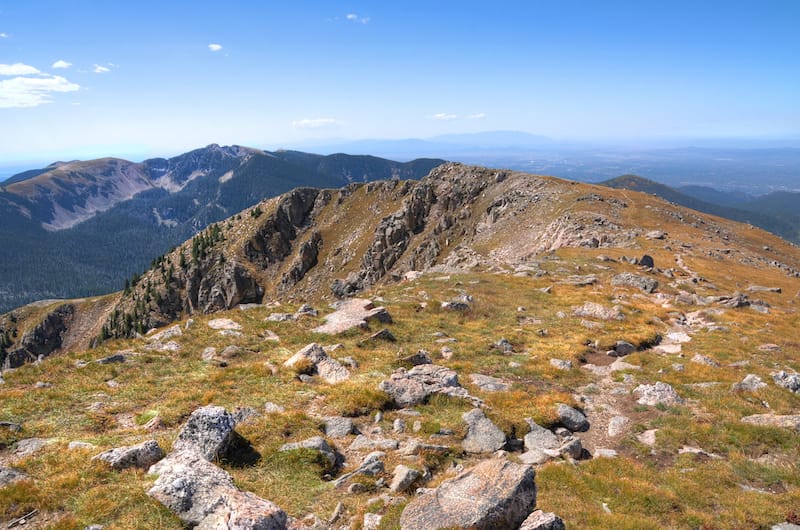
A popular hike near Santa Fe is the Baldy via Windsor Trail. It is a difficult trail that extends over 13.5 miles and is moderately trafficked.
This trail is best used from April until November and dogs are permitted on the trail.
The hike is pretty steady until it gets to the last mile which can be grueling. However, you will be rewarded at the top with stellar views over the New Mexican landscapes!
If you are looking to backpack this trail, you can camp at Lake Katherine. Just be sure to bring enough water and supplies for this hike as it truly is a challenge.
If you opt to do this hike in the Santa Fe winter, it is recommended to bring poles and snowshoes. In addition, the temperatures can become very, very cold (around 0 degrees Fahrenheit), so dress and prepare accordingly.
Raven’s Ridge Trail
Distance: 5.4 miles
Type of Trail: Out & back
Elevation Gain: 2,385 feet
Location: Santa Fe National Forest
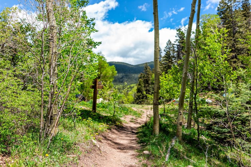
This 5.4-mile, the moderately-trafficked trail is one of the best challenging day hikes in Santa Fe and is a great trail if you’re an experienced hiker in New Mexico.
The trail is primarily used for hiking, horseback riding, and running. It is best used from April until October.
Dogs are permitted on the trail but must be on a leash. Bugs are prevalent along the trail so bring repellent if you’re susceptible to bites.
The trail is steep and rocky a lot of the way. To start out, you will need to start out on the Windsor Trail and take a right at the gate.
This is around one mile from the trailhead for Raven’s Ridge. For much of this trail, you will walk alongside a fence but will have epic views.
The parking lot is large but still opt for weekday hiking if you want to truly beat the crowds. There is tree cover throughout much of the trail but beware, it can be cold during the summer months so layer it up!
You can find exact instructions for this trail and the different peaks here on All Trails.
What to Pack and Wear
Here are some essentials that you should pack in an eco-friendly backpack for a day of hiking in Santa Fe, New Mexico:
Hiking boots: I swear by my Keen Targhee hiking boots and they are an excellent choice for traipsing the landscapes around this New Mexico city. Click here to see the Keen hiking boots I use.
Reusable water jug: Water is so essential if you’re on one of the hiking trails in Santa Fe and you definitely need to remain hydrated. I always tote along a Klean Kanteen water jug with me for the journey.
Sunscreen: Lather on up as some of these Santa Fe hiking trails have no shelter from the sun! The New Mexico sun is ruthless and you definitely need to put sunscreen on before your hike!
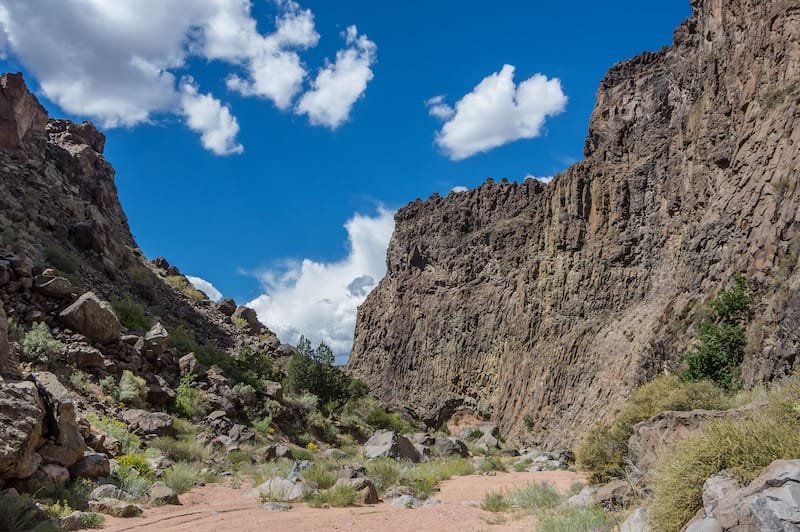
Light-colored clothing with long pants: Make sure you wear something that is light-colored and preferably, long, that covers your body from head to toe. Even though it is hot, you need to protect yourself from the sun and insects in the southwestern desert.
Park map: I recommend downloading an offline map from Alltrails before taking to the hikes around Santa Fe.
We hope that you have found a great place to escape the city on this guide to the best Santa Fe hiking trails!
One of the coolest things about hiking in Santa Fe is that there are so many varied landscapes that it really makes you feel like you’re hiking somewhere new each time.
If you have any favorite Santa Fe hikes, please drop them in the comments! Thanks!
Additional New Mexico Resources
- Best places to see in New Mexico
- Small towns in NM
- Best hikes near Albuquerque
- Things to do in Santa Fe
- Santa Fe day trips
- What to do in Ruidoso
Pin this Santa Fe Trails Guide

Megan is a travel blogger and writer with a background in digital marketing. Originally from Richmond, VA, she now splits her time between Frankfurt, Germany and Arctic Finland after also living in Norway, Armenia, and Kazakhstan. She has a passion for winter travel, as well as the Nordic countries, but you can also find her eating her way through Italy, perusing perfume stores in Paris, or taking road trips through the USA. Megan has written for or been featured by National Geographic, Forbes, Lonely Planet, the New York Times, and more. She co-authored Fodor’s Travel ‘Essential Norway’ and has visited 45 US states and 100+ countries.

